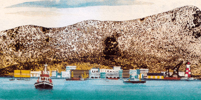
Capital: Aden
Location: On the coast of the Gulf of Aden, in the southern part of the Arabian Peninsula. The Yemen People’s Democratic Republic (PDR) has borders with Saudi Arabia, Oman and the Yemen Arab Republic. The country also includes the islands of Kamaran and Perim in the Red Sea, and the island of Socotra in Indian Ocean.
Area: 332,968 sq km
National composition: Mostly Arabs, Indians and Pakistani minorities
Religion: Islam
Official language: Arabic
Currency: Dinar = 1,000 fils
Administrative divisions: 6 govenorates
Other major cities: Al Mukalla
Highest elevation: Tamir (2,512m)
Chief rivers: Massila, Hajr
Climate: Tropical, arid climate; the only substantial precipitation occurs in the mountains
The Yemen PDR is largely mountainous. The fertile Hadhramaut Plateau has savanna vegetation which merges northward into total desert. A narrow coastal strip is fertile. The wildlife includes various birds of prey, lizards and reptiles.
Farming employs 45 percent of the work-force, as compared with 15 percent in industry. Citrus fruits, coffee, cotton, dates and millet are grown on irrigated land. The country has few mineral deposits. Manufacturing is concentrated in Aden, an international seaport and air junction located at the mouth of the Red Sea.