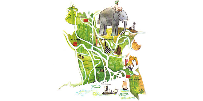
Capital: Dhaka
Location: On the Bay of Bengal; Bangladesh is bordered mainly by India, with Burma in the extreme south-east
Area: 143,998 sq km
National composition: Bengali (98%), Bihari and Tribes of the Tibeto – Burman language group
Religions: Islam (80%), Hinduism, Buddhism, Christianity
Official languages: Bengali, English
Currency: Taka = 100 poisha
Administrative divisions: 4 regions
Other major cities: Chittagong, Khulna, Naraayanganj, Rajshahi
Chief rivers: Ganges (Ganga), Jamuna (Brahmaputra)
Climate: Equatorial monsoon type, with frequent typhoons that cause flooding
Bangladesh is a flat country occupying the delta of the Ganges and Jamuna (Brahmaputra), which frequently bring devastating floods. The original vegetation has been largely replaced by rice paddies and jute fields. Agriculture now employs three-quarters of the work-force and Bangladesh is a leading jute producer. Cotton, sugar cane, tea and tobacco are also important. The wet and hot climate makes it possible to harvest as many as three crops per year.
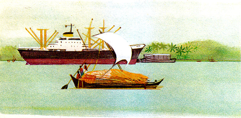
Local industry produces jute and cotton goods, cement, paper and sugar. The transport system largely depends on the dense system of waterways. Dhaka (Dacca) has an international airport.
One comment
Pingback: Intex South Asia 2019: Colombo Textile Exhibition - Textile Industry Events