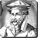
 The first world map was chiseled on a clay tablet in ancient Babylon in 6 BC. The Greeks in 4 BC had similar maps though they correctly believed that the earth was not flat, but a sphere. The first reasonably accurate world map was drawn by hand on paper by Gerardus Mercator, a Flemish geographer. His first world map was produced in 1538 and improved upon in 1585.
Related Articles


Check Also
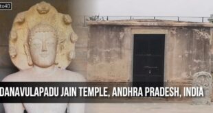
Danavulapadu Jain Temple, Kadapa District, Andhra Pradesh, India
Danavulapadu Jain Temple is an ancient Jain center located in Danavulapadu village, within the Jammalamadugu …