Singapore : Country Name
System of government: Republic
Capital: Singapore
Location: The island of Singapore and adjacent islands lie off the southern tip of the Malay Peninsula
Area: 581 sq km
National composition: Chinese (78%), Malays (14%), Indians, Pakistanis and other minorities
Official languages: Malay, Chinese, English, Tamil
Currency: Singapore dollar = 100 cents
Administrative divisions: 5 districts
Climate: Wet equatorial
Motto: “Majulah Singapura” Template:Ms icon
“Onward, Singapore”
Anthem: Majulah Singapura
“Onward, Singapore”
Singapore Map:
Singapore Encyclopedia & Facts For Kids:
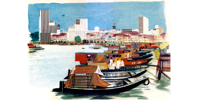
The densely populated, flat island of Singapore is one of the world’s busiest air and naval shipping centres. More than 60 regular maritime routes converge on it. Singapore has huge dock and ship repair facilities, port and storage facilities, oil refineries producing fuels, and the world’s largest tin smelting plant.
A centre of light industry, it exports electronic and optical instruments, textiles and utensils. Singapore is linked by rail with Malaysia.
Geography:
Country consists of 63 islands, is slightly more than 3.5 times the size of Washington, DC. Land reclamation has resulted in an increase of land area from 224 square miles (581.5 square kilometers) in the 1960s to 269 square miles (697.2 square kilometers) in 2007. About 23 percent of land area consists of forest and nature reserves.
The Johor-Singapore Causeway connects Singapore to Malaysia in the north, crossing the Tebrau Straits; and Malaysia-Singapore Second Link is a bridge from western Singapore to Johor. The highest point of Singapore is Bukit Timah Hill, with a height of 538 feet (166 meters).
Country has a tropical rainforest climate with no distinct seasons, characterized by uniform temperature and pressure, high humidity, and abundant rainfall. Temperatures range from 72F to 93F (22° C to 34° C). On average, the relative humidity is around 90 percent in the morning and 60 percent in the afternoon. During prolonged heavy rain, relative humidity often reaches 100 percent.
The only remaining area of primary rainforest is the Bukit Timah Nature Reserve. A variety of parks are maintained, such as the Botanic Gardens. With no natural freshwater rivers and lakes, rainfall, collected in reservoirs, supplies approximately 50 percent of water. The remainder is imported from Malaysia or obtained from recycled water, a product called NEWater, and desalination plants.
New towns built since the 1960s have resulted in an entirely built-up and urban landscape. About 83 percent of country’s population lives in housing estates constructed by the Housing and Development Board.
As a result of controls on motorized traffic, the maintenance of natural greenery, and strict regulations on industrial locations and emissions, it has been able to control its pollution levels to within World Health Organization standards.
External Links:
Business Events Happening In Singapore:
- ATXSG: Asia Tech x – Technology, Society & Digital Economy
- AWE Asia: Augmented World Expo Asia
- Earthquake Expo Asia
- FHA – Food & Beverage
- Flood Expo Asia
- Gastech: Expo
- Heat & Fire Expo Asia: Singapore
- ProWine Asia: Wines & Spirits
- SFF Expo: Fintech Festival
- Stainless Steel World Asia Conference & Expo
- Storm Expo Asia