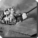
 Photographs of the ground taken by high flying aircraft were used in wartime to obtain information about enemy territory. After World War II, air photography became the chief method of mapping the detail of the land. Because overlapping photographs viewed through a stereoscope produce a three dimensional image, air photographs can also be used to measure the height of points on the land.
Related Articles


Check Also

Con City: 2026 Arjun Das & Yogi Babu Tamil Mystery Comedy Family Drama Film Trailer & Review
Movie Name: Con City Directed by: Harish Durairaj Starring: Arjun Das, Yogi Babu, Anna Ben, …