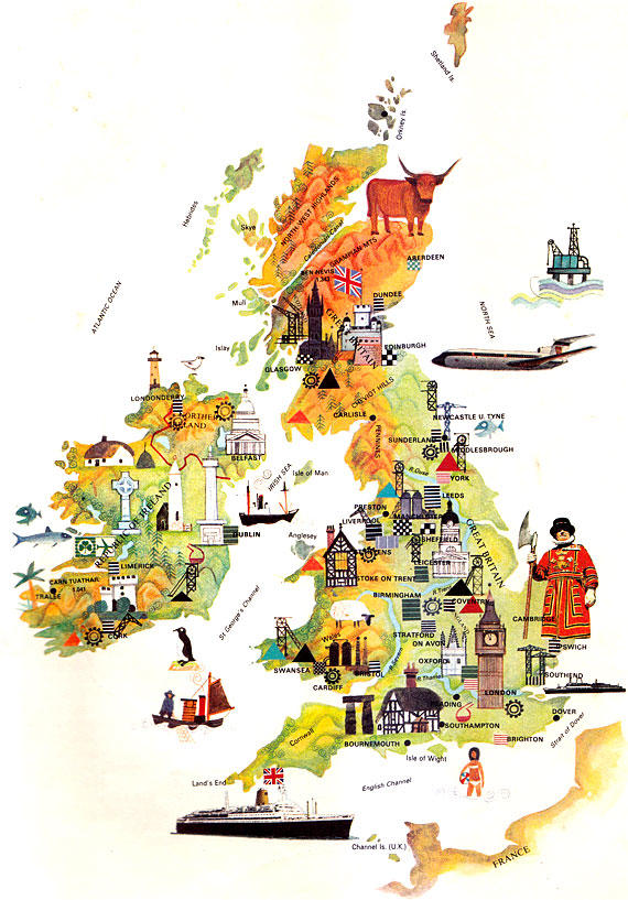
System of government: Constitutional Monarchy
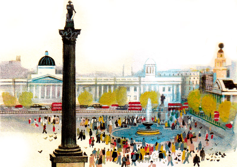
Capital: London
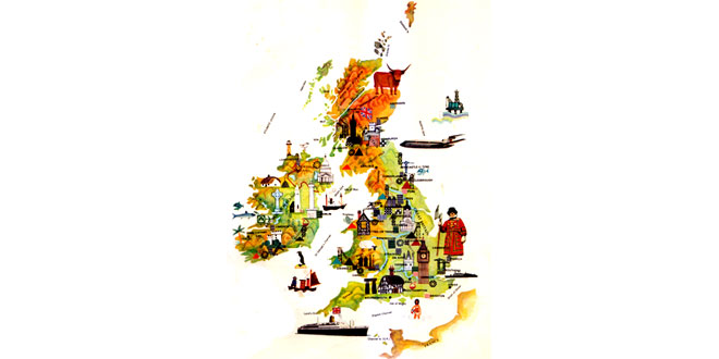
Location: An island kingdom of western Europe in the British Isles, including the Great Britain (England, Scotland, Wales) and Northern Ireland. It contains many smaller islands, including the Shetlands, Orkneys and Hebrides in Scotland, Anglesey in Wales and the Isle of Wight, England. It is separated from the continent of Europe by the English Channel and the North Sea
Area: 244,805 sq km
National composition: In England, 83%; in Scotland, 9%; in Wales, 5 %; in Northern Ireland, 3%
Religion: The Church of England is England’s main church. The Church of Scotland, various Protestant churches and the Roman Catholic Church are also important
Official language: English (also Welsh in Wales)
Currency: Pound sterling = 100 pence
Administrative divisions:
- Kingdom of England: Density per sq km – 356
- Principality of Wales: Density per sq km – 134
- Kingdom of Scotland: Density per sq km – 65
- Province of Northern Ireland: Density per sq km – 110
The country is further divided into counties, regions (in Scotland) and municipal boroughs
Other major cities: Birmingham, Glasgow, Leeds, Sheffield, Liverpool, Bradford, Manchester
Highest elevation: Ben Nevis in Scotland
Chief rivers: Severn, Thames
Climate: Wet, with mild winters and warm summers.
Average temperatures: January, 3.5 Degree Celsius – 7 Degree Celsius; July, 11 Degree – 18 Degree Celsius. Rainfall generally decreases from west to east
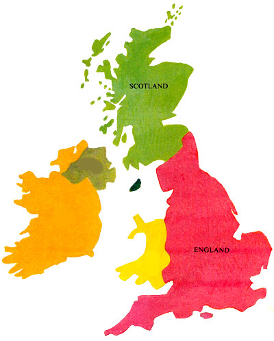
The United Kingdom consists of England, Scotland and Wales, which together form Great Britain, and Northern Ireland. Geographically, the United Kingdom is part of Europe and, since 1973, it has been a member of the European Economic Community. The Isle of Man and the Channel Islands are not part of the United Kingdom, but they are self-governing dependencies of the British Crown.
At the end of the Ice Age, around 10,000 years ago, the British Isles were joined to the European mainland. As the ice melted, the English Channel filled up and England was finally cut off about 7,500 years ago.
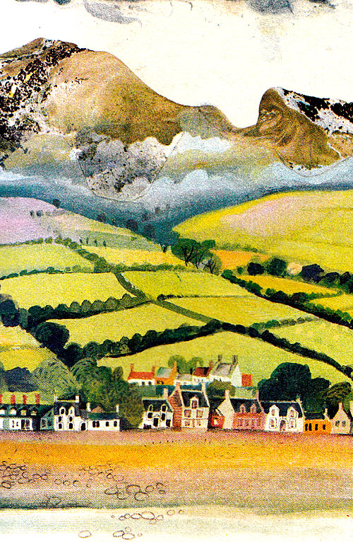
Great Britain can be broadly divided into the highlands of the north and west and the lowlands of the south and east. Scotland is the most mountainous area. The north includes the North-west Highlands and the Grampians, as well as many rugged islands. Between the North-west Highlands and the Grampians is a depression, the Great Glen, which contains the Caledonian Canal, a waterway linking the east and west coasts. Loch Ness, famed for its reputed monster, forms part of this waterway. South of the Grampians are the Central Lowlands, which contain valuable mineral deposits and fertile farmland. Southern Scotland is made up of the rolling Southern Uplands, with the volcanic Cheviot Hills on the border with England.
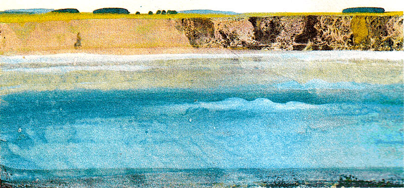
The Pennine Chain forms the backbone of northern England, while the scenic Cimbrian Mountains are in the north-west. The many ice-worn lakes and beautiful countryside make the famed Lake District of Cumbria one of England’s main tourist attractions. Other uplands enjoyed by many visitors are Exmoor and Dartmoor in the south-west. But most of southern England is low-lying, with ranges of low hills separated by clay vales. This region contains the UK’s best farmland.
Wales is largely mountainous and dominated by the Cambrian Mountains. Northern Ireland contains rolling hills, valleys and dales. Its highest range is the Mountains of Mourne. Northern Ireland also contains the country’s largest lakes: Lough Neagh and Lough Erne.
Britain was once densely forested, with abundant oaks, birches, alders, ash trees, willows, pines and spruce. But forests now cover only about 7.5 per cent of the country. The destruction of forests and other habitats has greatly reduced the wildlife, although Britain remains rich in bird life, particularly sea birds. Awareness of the need to conserve the environment has led to the establishment of 10 National Parks and 33 ‘areas of outstanding natural beauty’ in England, Wales and Northern Ireland, with 40 ‘national scenic areas’ in Scotland.
About 30 per cent of the country is used for growing crops, and 50 per cent is pasture, used especially for dairy and beef cattle. Sheep, pigs and poultry are also reared. Cereals, notably barley and wheat, fruit, hops and vegetables are leading crops. Although only 2 per cent of the work-force is employed on farms, British agriculture is highly efficient. However, Britain still has to import food. The fishing industry provides another source of protein.
About 42 per cent of the work-force is employed by industry, including mining and manufacturing. Natural gas and oil are are extracted from deposits under the North Sea, and the country also has reserves of coal and iron. Britain was the cradle of the Industrial revolution and her industries have enjoyed a long tradition, especially in engineering (cars, aircraft, tractors, shipbuilding), machine tools, finished textiles and processed foods. Chemicals, steel, glassware and pottery are also among the country’s leading exports. ‘Invisibles’, derived from banking, insurance, tourism and other services, are also important in the British economy.
The country has extensive rail and road networks, although the canals which were important in the early days of the Industrial Revolution, have declined in significance. The United Kingdom is also one of the world’s leading nations in air transport and shipping.
The United Kingdom is one of the world’s most developed countries, although it has declined in recent years as compared with some of its competitors. For example in 1981, it ranked seventh among the 10 members of the EEC in terms of its per capita GNP (the gross national product divided by the population). But with sizeable electronics and computer industries, it seems well placed for future development.
The United Kingdom once controlled the largest empire in history. Much of this empire is now united in Commonwealth, a free association of independent nations. The following territories remain under British rule:
- Anguilla – Associated state in the Caribbean
- Bermuda – Colony in the Atlantic Ocean, east of the US mainland
- British Indian Ocean Territory – Colony in the Indian Ocean
- British Virgin Islands – Colony in the eastern Caribbean
- Cayman Islands – Colony in the Caribbean, south of Cuba
- Falkland Islands – Colony east of southern Argentina, whose claims on the islands led to military conflict in 1982
- Gibraltar – Colony on the southern tip of the Iberian Peninsula
- Hong Kong – Colony on the southern coast of China, which is due to revert to China, by agreements, in 1997
- Monsterrat – Colony in the Leeward Islands in the West Indies
- Pitcairn – Colony in the Pacific Ocean
- St Helena – Colony in the Atlantic, west of South Africa
- Turks and Caicos Islands – Colony south of the Bahamas