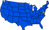
 Maryland, one of the Middle Atlantic states of the United States, ranks 42d among the states in area, 19th in population size, and is a leading state in population density. CHESAPEAKE BAY, the largest bay in the continental United States, almost severs the state, dividing the Eastern Shore–which is located on the DELMARVA PENINSULA (shared by Delaware, Maryland, and Virginia)–from the Western Shore. Maryland is irregularly shaped, with a maximum east-west extent of 320 km (199 mi) and a north-south extent that ranges from about 5 km (2 mi), near Hancock, to a maximum of 201 km (125 mi). The straight northern boundary with Pennsylvania is part of the MASON-DIXON LINE, which was established in 1769; the southern and western boundary with Virginia and West Virginia follows the Potomac River except where the District of Columbia intervenes; Delaware lies to the east.
One of the 13 original states, Maryland was named for Queen Henrietta Maria, wife of Charles I of England. The area was first colonized in 1634 and played a major role in the nation’s early history and struggle for independence. During the Civil War, Maryland was divided on the issue of secession and was placed under military rule to keep it within the Union and protect the nation’s capital. The state capital is ANNAPOLIS, which lies within the metropolitan area of BALTIMORE, Maryland’s largest city.
Land & Resources
 From east to west, Maryland cuts across the major physiographic divisions of the eastern United States–the Coastal Plain, the Piedmont, and the Appalachian Mountains. The Coastal Plain occupies all of eastern Maryland, including both shores of the Chesapeake Bay.
It is underlain by sedimentary rock, and elevations are less than 30 m (100 ft) on the Eastern Shore and less than 60 m (200 ft) on the more rolling Western Shore. Along the Atlantic coast a series of low, sandy barrier islands and vast stretches of swampy and tidal wetlands surround Chesapeake Bay. The Coastal Plain is bounded on the west by the FALL LINE, which extends roughly from the head of Chesapeake Bay southwestward through Baltimore to the boundary between Prince Georges and Montgomery counties in suburban Washington, D.C. West of the fall line is the PIEDMONT PLATEAU, which is part of the Appalachians and underlain mostly by igneous and metamorphic rocks. Elevations rise to 400 m (1,300 ft), and the rolling surface is well suited for agriculture except where cut by steep-sided valleys.
The BLUE RIDGE MOUNTAINS begin west of Frederick and extend southwest-northeast across the state as a prominent, forested ridge, with summits reaching about 520 m (1,706 ft). West of the Blue Ridge lies the Great Valley, an elongated plain extending from Virginia into Pennsylvania that has provided easy northeast-southwest access since colonial times and was part of the Cumberland Gap route to the Middle West. Most of Western Maryland consists of a series of parallel ridges and valleys, part of the Ridge and Valley section of the APPALACHIAN MOUNTAINS. In far western Maryland is a tiny portion of the steep hills and winding valleys of the Appalachian Plateau where Backbone Mountain, Maryland’s highest point, reaches 1,024 m (3,360 ft).
Climate
Climatic conditions vary more from east to west and with altitude than from north to south. The Coastal Plain has hot summers, mild winters, and a growing season usually longer than 200 days. Temperatures average above 1 deg C (34 deg F) in January, and more than 23 deg C (74 deg F) in July; annual precipitation is generally more than 1,070 mm (42 in), and snowfall is less than 510 mm (20 in). In the Piedmont temperatures average 1 deg C (34 deg F) in January and 24 deg C (76 deg F) in July; the growing season is 160 to 200 days, precipitation is less than 1,070 mm (42 in), and snowfall is moderate, between 510 mm (20 in) and 760 mm (30 in). The mountainous west has severe winters, with temperatures generally below freezing and snowfall totaling between 1,020 mm (40 in) and 2,540 mm (100 in).
Summers are cool, with the average temperature in July less than 21 deg C (70 deg F), and the growing season is less than 160 days.
Historical Sites and Recreation
Historical sites trace Maryland’s important role in U. S. history. St. Mary’s city was the location of the first settlement in the state in 1634. Chestertown, on the eastern shore, has historic homes, as does Annapolis, an important colonial tobacco port and the country’s oldest state capital; it also briefly was the U. S. capital. Cumberland, in the west, was the eastern point of the Cumberland Trail, and Ellicott City was the original western terminus of the B&O railroad. The National Colonial Farm at Accokeek is a restored 18th-century tobacco plantation. Nationally maintained places of interest include FORT MCHENRY National Monument and Historic Shrine in Baltimore, where Francis Scott KEY wrote “The Star-Spangled Banner” during the War of 1812; the Chesapeake and Ohio Canal National Historical Park, connecting Washington with the west; and the Civil War Antietam National Battlefield, near Sharpsburg. The Appalachian National Scenic Trail crosses the state, and Assateague Island National Seashore is famous for its herds of wild ponies.
CAMP DAVID , the presidential retreat, lies in the Catoctin mountains near Thurmont. Ocean City is a popular Atlantic Ocean resort, and Chesapeake Bay offers quality sailing, fishing, and duck hunting areas. State parks and forests provide hiking and camping facilities. Professional sports teams include the Baltimore Oriole baseball team, playing in a new stadium near the waterfront and close to Babe Ruth’s boyhood home, and the Washington Capitals basketball team in suburban Maryland. Baltimore’s Pimlico Race Course, site of the Preakness, and Laurel have nationally-known horse racing tracks. and Rosecroft Raceway, near Washington, has harness racing.
History
Giovanni da VERRAZANO is thought to have visited the Atlantic coast near Chincoteague Bay in 1524. In 1526, Spanish explorers sailed into Chesapeake Bay and called it Santa Maria, a name that appears on a 1556 map. In 1608, Captain John SMITH of Virginia became the first authenticated European visitor. In late 1631, William Clairborne established a fur-trading post, which is regarded as the first permanent European settlement, on Kent Island (opposite Annapolis). At the time of early European settlement, the principal Indian groups were three Algonquian tribes–the Piscataway on the Western Shore, who left the area in 1697; and the Nanticoke and Pocomoke-Assateague on the Eastern Shore, who migrated westward in the 1740s. The Susquehannock also inhabited the area, but in 1675 they were carried into captivity by the Iroquois Nations.
In 1632, King Charles I of England granted George Calvert, 1st Baron Baltimore (see CALVERT family), settlement rights to lands between the 40th parallel and the south bank of the Potomac. Calvert died before the papers were complete, and the charter passed to his son Cecilius (Cecil) Calvert, 2d Baron Baltimore. In November 1633, 200 colonists set sail from England in the Ark and the Dove, which landed on Mar. 24, 1634, at Saint Clement (now Blakistone) Island at the mouth of the Potomac. They purchased the Indian village of Yaocomico, which they renamed St. Mary’s (now St. Mary’s City) and used for 60 years as the capital and center of the colony. Lord Baltimore, a Roman Catholic, sought religious freedom for the colony, and in 1649 the Colonial Assembly passed the Act Concerning Religion, the first statute in the colonies to provide freedom of worship for all Christians.
From 1692 to 1715, Maryland was a crown colony, ruled by royal governors. During this period the Church of England was the official religion, and in 1694 the capital moved to Annapolis. The Baltimores regained control in 1715. At first the colony had a diversified agriculture, but by the end of the 17th century tobacco was the staple crop.
In the Revolutionary period, Maryland was one of the first colonies to repudiate the STAMP ACT (1765). Early in the colonial resistance to British rule, Marylanders had their own “tea party,” in 1774 in Chestertown when the tea-carrying ship Peggy Stewart was burned in Annapolis harbor. On July 3, 1776, the state disavowed its allegiance to the king, and 4 months later was the first of the former colonies to adopt a state constitution. Marylanders were active in both Continental Congresses and in the signing of the Declaration of Independence. During the Revolutionary War, Maryland troops distinguished themselves in battles outside the state, but no fighting took place in the state. In 1788, Maryland became the 7th state to ratify the U.S. Constitution, and in 1791 it ceded to the nation 174 sq km (67 sq mi) along the Potomac for construction of the District of Columbia.
Maryland’s early years of statehood were spent in developing the state’s resources. Shipping and trade expanded, and families abandoning the worn-out tobacco farms of the Eastern Shore and southern Maryland migrated westward into the Piedmont. Baltimore, incorporated in 1797, grew rapidly as a port, shipbuilding, and industrial center, attaining a population of 26,500 (more than Boston) in 1800 and 169,000 in 1850. New transportation facilities integrated the growing trade of lands west of the Appalachians into the region. Among the more important routes were the NATIONAL ROAD (1818); the Chesapeake and Delaware Canal (1829) across the Delmarva Peninsula; the CHESAPEAKE AND OHIO CANAL along the Potomac River to Cumberland and the coalfields of western Maryland; and the Baltimore and Ohio Railroad, the first U.S. passenger railroad, begun in 1828.
At the outbreak of the Civil War, Maryland had almost equal numbers of slaves and free blacks, and the state was sharply divided in its sympathies to North and South. However, when neighboring Virginia seceded, Maryland’s presence within the Union became vital to the defense of Washington, D.C., and President Lincoln was forced to prevent secession by imposing military rule. Fierce battles fought on Maryland soil included the battles of South Mountain and ANTIETAM (both in 1862) and Monocacy (1864).
After the Civil War, manufacturing expanded rapidly, except during the 12-year depression following the Panic of 1873, and eventually emerged as the mainstay of the economy. Thousands of Greek, German, Italian, Russian, Polish, and other immigrants, together with blacks migrating from rural counties, flocked to take jobs in Baltimore’s textile and other factories.
From 1870 to 1895 transportation interests, led by Arthur P. Gorman and I. Freeman Rasin, dominated state politics and kept Democrats in power. In 1895 the Gorman-Rasin machine was overthrown, but Democrats continued to dominate state politics and have since lost the governorship to Republicans only five times. In 1904, Baltimore was devastated by fire but recovered to grow rapidly as World Wars I and II increased demand for the city’s industrial products. More recently, Washington-related research and other industries have increased the state’s prosperity.
Race relations in Maryland were severely strained by the 1954 U.S. Supreme Court decision to end segregation, and widespread rioting occurred in the 1960s, mostly in Baltimore. Spiro T. AGNEW, Maryland’s fifth Republican governor since 1895 (1967-69), was elected U.S. vice-president in 1968 and 1972. In 1973, however, he resigned the office during an investigation of charges of graft while he was a Maryland official. Governor Marvin Mandel, Agnew’s Democratic successor, was indicted on similar charges in 1975, convicted in 1978 on charges of mail fraud and racketeering, and sentenced to jail. Forced by Maryland law to resign, Mandel resumed office for the 45 hours of his remaining term after the overturn on appeal (later reversed) of his conviction in January 1979. Since then the Maryland governorship has remained in the hands of the Democratic party.
Land
- Area: 32,135 sq km (12,407 sq mi); rank: 42d.
- Capital: Annapolis (1990 pop., 33,187).
- Largest city: Baltimore (1990 pop., 736,014).
- Counties: 23.
- Elevations: highest–1,024 m (3,360 ft), at Backbone Mountain near Kempton, W.Va.; lowest–sea level, at the Atlantic coast.