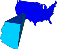
 Arizona, the sixth-largest state of the United States, in terms of area, is located in the Southwest. It is bordered by Utah on the north, by Colorado on the northeast, by New Mexico on the east, by Mexico on the south, and by California and Nevada on the west; its northeast corner is the only point in the United States shared by four state boundaries. Known as the Grand Canyon State, Arizona is one of the fastest-developing states of the U.S. Sunbelt. Its population is increasing at a rapid rate, and its diversified economy is dominated by manufacturing industries, many established as recently as the 1960s and 1970s. Arizona’s name is derived from the Pima Indian village of Arizonac (formerly located in what is now Mexico, near modern Nogales, Ariz.), where silver was found by Spaniards about 1736. The word Arizonac probably means “place of the small spring.”
Land & Resources
 Arizona includes many areas of great natural beauty and geological interest. The highest point in the state is Humphreys Peak (3,851 m/12,633 ft), near FLAGSTAFF, and the lowest point is 21 m (70 ft) above sea level, in the southwest along the Colorado River. The approximate mean elevation of Arizona is 1,250 m (4,100 ft). Nearly 45% of the state’s land area is owned by the federal government and includes about 20 Indian reservations.
Physiographic Regions
Arizona may be divided into two major geographic regions, each of which is part of a larger physiographic area. In the north is a section of the COLORADO PLATEAU, and in the south and west is a part of the Basin and Range Region.
The Colorado Plateau area, about two-fifths of the state, comprises a series of generally level plateaus, mostly separated by steep-sided chasms. The elevation is mainly between 1,525 and 2,440 m (5,000 and 8,000 ft), although some areas, such as the extensive Kaibab Plateau (2,835 m/9,300 ft high) and the volcanic San Francisco Peaks (one of which is Humphreys Peak), are higher. Other notable features of the Colorado Plateau include the 1.6-km-deep (1-mi) GRAND CANYON of the Colorado River; the CANYON DE CHELLY, with sheer red cliffs; the PAINTED DESERT, an extensive area of colorful sand and rock formations; the PETRIFIED FOREST, with great “logs” of jasper and agate; and MONUMENT VALLEY (astride the border with Utah), containing monumental red-sandstone buttes about 305 m (1,000 ft) high.
The Mogollon Rim, an escarpment (about 609 m/2,000 ft high) that extends diagonally from central Arizona to southwest New Mexico, in part separates the Colorado Plateau from the Basin and Range Region. The latter comprises several northwest-southeast trending mountain ranges, close together in central Arizona but separated by wide valleys in the southern part of the state. Ranges in the central region include the Black, Hualapai, Mazatzal, Superstition, and Gila Bend mountains; crest elevations are generally from 2,135 to 3,355 m (7,000 to 11,000 ft). The southern Arizona ranges include the Pinaleno, Chiricahua, Huachuca, Santa Rita, Santa Catalina, and Mohawk mountains; elevations are generally less than 1,340 m (4,400 ft), but isolated peaks rise more than 2,700 m (9,000 ft). In the southwest is the Sonoran Desert.
Rivers and Lakes
The COLORADO RIVER (rising in Colorado) and its tributaries drain most of Arizona. The Colorado flows for about 1,127 km (700 mi) in the state, entering in the north, then winding westward (in part through the Grand Canyon) before turning south to form most of Arizona’s western boundary. Important components of the Colorado system in Arizona include the GILA, Little Colorado, Bill Williams, Verde, Salt, and Santa Cruz rivers. The Central Arizona Project has carried water from the Colorado River to Phoenix since 1985. It is scheduled to be extended to Tucson. Most of the state’s rivers and streams are intermittent, flowing only after a rainfall; the Colorado flows at all times, however. Some mountain streams, such as Havasu, or Cataract Creek (in the Grand Canyon area), form impressive waterfalls.
Arizona’s few natural lakes are small and situated in mountain areas. But the state has several very large artificial lakes, created by damming rivers for irrigation, flood control, and power generation. These lakes include Lake MEAD and Lake Mohave (both partly in Nevada), Lake Powell (mostly in Utah), and Havasu Lake (partly in California), all on the Colorado River; Theodore Roosevelt Lake, on the Salt River; San Carlos Lake, on the Gila River; Bartlett Reservoir, on the Verde River; and Alamo Reservoir, on the Bill Williams River. The long-term Central Arizona Project, to carry scarce water eastward from the Colorado, connected with Phoenix in 1985 and with Tucson in 1990.
Climate
Because of its wide range of elevation and relief, Arizona has a varied climate pattern. The Colorado Plateau region has cool to cold winters and warm summers. In Flagstaff the mean January temperature is -3 deg C (28 deg F), and the average July temperature is 19 deg C (66 deg F). The Basin and Range Region has mild winters and hot summers. In PHOENIX, the centrally located state capital, the mean January temperature is 11 deg C (52 deg F), and the average July temperature is 33 deg C (92 deg F). The city usually has little cloud cover, and each year it receives about 86% of the possible sunshine, a very high percentage.
Arizona as a whole gets about 330 mm (13 in) of precipitation yearly. High mountains and plateaus receive somewhat more moisture (510-1015 mm/20-40 in per year, with up to 1.5 m/5 ft of snow), while the southwest gets much less precipitation (50-130 mm/2-5 in annually). Except in the extreme western part of the state, most of the precipitation occurs in the summer and winter months.
Vegetation and Animal Life
Vegetation in Arizona forms distinct zones, largely according to elevation. Lowland deserts, dominated by creosote bushes and sagebrush, include many cacti, notably the giant saguaro (whose blossom is the state flower), and yucca, such as the tall Joshua tree. The useful (because it is edible and indicative of groundwater) mesquite tree is also found in desert regions. Grasslands, some pure and others shrub-dotted, are common at somewhat higher elevations. The grasslands merge into woodlands of oak and chaparral in the warmer areas and into woodlands of pinon, juniper, and other pine trees in the cooler locations. Above the woodlands, from about 2,135 to 2,745 m (7,000-9,000 ft), are dense stands of valuable ponderosa pine. At high altitudes are forests of Douglas fir and spruce mixed with such deciduous trees as aspen, oak, and maple.
Altogether, about 25% of Arizona is forested, but less than 20% of this area has commercial value. Virtually all the commercial timberland is controlled by the federal government, mostly in the state’s seven national forests.
Arizona has large numbers of wildlife. Bigger animals include black bear, mountain lions, desert bighorn sheep, mule deer, white-tailed deer, antelope, and elk. Among the smaller wild animals are jackrabbits, beavers, squirrels, and chipmunks. The state’s numerous reptiles include the poisonous Gila monster and other kinds of lizards; rattlesnake; and coral snakes. More than 400 species of birds, including both rarities, such as the elegant trogon, and common types, such as the roadrunner, are found there.
Historic Sites
Arizona has several highly interesting remains of past Indian cultures. These include cliff dwellings in MONTEZUMA CASTLE NATIONAL MONUMENT, near Camp Verde; Navajo National Monument, near Tonalea; Tonto National Monument, at Roosevelt; and Walnut Canyon National Monument, near Flagstaff. Also of historical interest are the 800-year-old Hopi Indian pueblo of Oraibi and ruins of pueblos in Tuzigoot National Monument, near Clarkdale, and Wupatki National Monument, near Flagstaff. Among other historic sites are the Spanish Roman Catholic mission of San Xavier del Bac in Tucson and the city of TOMBSTONE, containing many reminders of the time when it was a lawless silver-mining boom town. The noted American architect Frank Lloyd WRIGHT lived for many years in Arizona, and buildings he designed in the state include Taliesin West, in Scottsdale, and Gammage Center for the Performing Arts, at Arizona State University in Tempe.
Tourism
Tourism is one of Arizona’s major economic activities. Winter visitors are attracted mainly by the warm and dry climate in the southern part of the state, and summer tourists are lured principally by the state’s areas of great natural beauty. The state’s parks and monuments are primary attractions. There are also luxurious private resort hotels (notably in Scottsdale) and some dude ranches (formerly a mainstay of the state’s tourist industry).
History
Indians first inhabited the region that is now Arizona between about 25,000 and 10,000 years ago. Agriculture was introduced about 2000 BC in the southeast and spread northward. By 300 BC, maize, squash, beans, and cotton were grown, partly with the use of sophisticated irrigation systems. By AD 700 the HOHOKAM CULTURE, centered in the lower Salt and middle Gila river basins, was among the most productive and sophisticated Indian group north of present-day Mexico. Another highly developed culture group, the ANASAZI (of which the Hopi are descendants), lived on the Colorado Plateau. These people constructed many cliff dwellings that still exist. During the 16th and 17th centuries the Athapascan-speaking Apache and Navajo moved into eastern Arizona; by this time the Hohokam had abandoned their lands.
Spanish Presence
The first white person to enter Arizona was probably the Spanish explorer Alvar Nunez CABEZA DE VACA, in 1536. Three years later the Franciscan friar Marcos de Niza and the black slave Estavan passed through the San Pedro valley in search of the fabled Seven Cities of CIBOLA, reputed to contain great amounts of gold. In 1540-42, members of a party led by Francisco Vasquez de CORONADO, also attempting to find the Seven Cities, visited the Grand Canyon of the Colorado River and some Hopi villages. During the following 100 years several Spanish explorers and missionaries traveled in Arizona. One such visitor was Juan de ONATE, who went down the lower Colorado in 1605. In the early 17th century missions were established among the Hopi, Papago, and Pima Indians; the Hopi later ousted the missionaries during a great Indian revolt in 1680.
In the 1690s and early 1700s the Jesuit Eusebio KINO, founded missions at Tumacacori, Guevavi, and Bac (which is now called San Xavier and is still active), in the Santa Cruz valley, and at Quiburi, in the San Pedro valley. In 1752 Spanish soldiers established Arizona’s first white settlement, a presidio at Tubac, and in 1776 the presidio was transferred to Tucson. During the 18th century warfare occurred between the Spanish and Indians and between the Apache and other Indians. The whites and Apache were at peace from about 1790 to 1822, but in the later 1820s much fighting occurred in Arizona, since 1821 a part of independent Mexico.
U.S. Annexations
As a result of the MEXICAN WAR (1846-48) the United States annexed Arizona north of the Gila River, and the area was made part of the New Mexico Territory in 1850. The United States also sought the region south of the Gila, partly as a transportation route to California, and it gained this territory from Mexico through the GADSDEN PURCHASE (1853). In the late 1850s silver was mined near Tubac, and copper was produced at Ajo. Southern Arizona was settled mainly by Americans from the South, and during the Civil War considerable sentiment for the Confederacy existed. One military engagement occurred in Arizona, at Picacho Pass (between Casa Grande and Tucson) in April 1862.
On Feb. 24, 1863, the separate Union territory of Arizona was created. Its first capital was Fort Whipple; in 1864 Prescott was established nearby and made the capital. The capital was moved to Tucson in 1867, back to Prescott in 1877, and finally to Phoenix in 1889. In the 1860s several agricultural settlements, such as Gila Bend (1864), Phoenix (late 1860s), and Florence (1866), were founded, and in the 1870s and ’80s many large cattle and sheep ranches were established. In 1877 much silver was discovered at what became (1879) Tombstone. Also in the 1870s, the Mormons founded a number of settlements on the Colorado Plateau and in the Salt and upper Gila river valleys. In 1878 the railroad reached Yuma from California, and during 1881-83 a rail line was built westward across northern Arizona. From the 1860s to 1880s fighting occurred between whites and the Apache, led by chiefs MANGAS COLORADAS, COCHISE, and GERONIMO (surrendered 1886).
In the 1880s and ’90s several corporations opened large-scale copper mines, and the area of irrigated agriculture reached about 81,000 ha (200,070 acres) by 1900. The completion, in 1911, of Theodore Roosevelt Dam on the Salt River resulted in a considerable growth of irrigated farming. As the state’s economy and population grew, many Arizonans sought statehood for their territory. Having rejected proposals for the creation of a state including both Arizona and New Mexico, Arizona was permitted (1910) to draft a constitution by itself. The resulting charter was vetoed (1911) by President William Howard Taft, as it permitted the recall of judges by popular vote. After the recall provision was deleted, Taft signed (Feb. 14, 1912) the proclamation admitting Arizona as the 48th state. At the first state election the recall was restored.
Land
- Area: 295,275 sq km (114,006 sq mi); rank: 6th.
- Capital and largest city: Phoenix (1990 census, 983,403).
- Counties: 15.
- Elevations: highest–3,851 m (12,633 ft), at Humphreys Peak; lowest–21 m (70 ft), at the Colorado River.