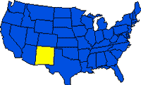
New Mexico, located in the southwestern United States at the southern end of the Rocky Mountains, borders Mexico on the south, Arizona on the west, Colorado on the north, Oklahoma on the east, and Texas on the east and southeast. With an area of 314,938 sq km (121,598 sq mi), it ranks fifth among the states in size. New Mexico’s population, however, is less than 1% of the total for the United States; it ranks 37th in the number of inhabitants. Hispanics form about 38% of the state’s population, and Indians constitute about 9%. Like other southwestern states, New Mexico has been experienced an in-migration of Anglos from the midwestern and eastern states. Population growth of 28.1% between 1970 and 1980 and 16.3% from 1980 to 1990 showed a sharp increase when compared to the 6.9% for the period between 1960 and 1970.
Initially explored and settled by Spaniards, the area remained a Spanish–and then Mexican–territory until annexation by the United States in 1846. Statehood was achieved in 1912.
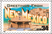
The name New Mexico was given to the state to distinguish it from the independent nation to its south. Its scenic beauty and unique cultural characteristics are reflected in New Mexico’s nickname, Land of Enchantment. SANTA FE, founded in 1609, is the state capital.
New Mexico has been a major contact point between three cultures–Indian, Spanish-Mexican, and Anglo-American. Historically a land of cattle and sheep ranching with some irrigated agriculture, the state is experiencing new growth based on tourism, retirement communities, aerospace and defense research and testing, and the development of petroleum, natural-gas, and other energy resources.
New Mexico State: Land & Resources
 New Mexico encompasses a variety of landforms, which may be divided into four major regions, all of which extend beyond its borders: the ROCKY MOUNTAINS, the GREAT PLAINS, the BASIN AND RANGE PROVINCE, and the COLORADO PLATEAU. In north central New Mexico are the southern Rocky Mountains, dominated by the San Juan and Sangre de Cristo ranges. The highest elevations in the state are found there. The RIO GRANDE flows between these two mountain systems and continues south to follow a small part of the boundary between New Mexico and Texas. Eastern New Mexico is made up of a section of the Great Plains, traversed by the CANADIAN RIVER and PECOS RIVER. A flat strip of land along the Texas border is known as the Llano Estacado (Staked Plains) or High Plains. Much of southern New Mexico is part of the basin and range province.
Several rugged north-south mountain ranges, particularly the Black, San Andres, Sacramento, and Guadalupe, are separated by basins, including the Jornada del Muerto and the Tularosa. The state’s fourth region, a section of the Colorado Plateau, is in northwest New Mexico. It is a high-lying area with extensive valleys, deep canyons, mesas, buttes, and colorful sandstone formations.
Climate
Three distinct climatic regions are discernible in New Mexico: the semiarid eastern plains, the western deserts, and the mountain areas, where conditions result in sharply increased moisture. The distance from moisture sources and the presence of the subtropical high-pressure zone account for the western deserts. The greater rainfall of the eastern plains results from a summer inflow of warm, moist air from the Gulf of Mexico.
Aridity, warm-to-hot summers, and mild-to-cold winters are the dominant climatic characteristics of New Mexico. Precipitation averages less than 400 mm (16 in), and summer temperatures often climb to 38 deg C (about 100 deg F). Snow covers the northern third of the state and the higher elevations in the winter months. The southwestern desert receives about 200 mm (8 in) of rain, yet precipitation exceeds 1,000 mm (39 in) in the Sangre de Cristo range in the north. Most precipitation occurs in the summer as convectional thunderstorms, but a second, smaller concentration is associated with the passage of winter storm fronts.
Tourism
Tourism is an increasingly important aspect of the state’s economy as its abundant recreational, scenic, and historic sites are developed. Desert landscapes, mountains, forests, and clear skies with spectacular sunsets provide a backdrop for the great cultural diversity of Indian pueblos, Spanish colonial settlements, abandoned mining camps, and modern cities. CARLSBAD CAVERNS National Park and 9 national monuments are in the state, and Texas’s Guadalupe Mountains National Park is nearby. White Sands National Monument also attracts many tourists. The state maintains a system of 43 state parks. Many camping sites and picnic areas are available on national forest, state, and Indian lands. Resort areas include the mountain fringe near Santa Fe and Taos, thermal mineral baths at Truth or Consequences, and winter sports centers in the Sangre de Cristo, Sandia, and Sacramento mountains.
New Mexico State: History
Indians first lived in New Mexico about 20,000 years ago, developing the FOLSOM and Sandia cultures, named for the sites in the state where artifacts were found. Around AD 1000 the ANASAZI developed an advanced culture in northwestern New Mexico; the Mogollon Indians lived in the southwest. By about 1500 these groups had migrated, and the APACHE, COMANCHE, and NAVAJO moved in. The Apache and Navajo roamed through the region, and the PUEBLO Indians–descendants of the Anasazi–cultivated maize, beans, and squash in irrigated plots along the Rio Grande.
The first white persons to visit present-day New Mexico were probably Alvar Nunez CABEZA DE VACA and some Spanish companions in 1536. The Franciscan priest Marcos de Niza and his black slave Esteban entered the area in 1539, searching for the Seven Golden Cities of CIBOLA (actually ZUNI villages that contained no particular wealth). Several other Spanish expeditions followed, including those of Francisco Vazquez de CORONADO and Antonio de Espejo. Juan de ONATE entered in 1598 from New Spain, now Mexico, following the route of the Rio Grande valley, and the first European settlements were established at San Juan Pueblo in 1598 and Santa Fe in 1610.
Under Spanish colonial rule, and then under Mexico, the area remained a region of cattle and sheep grazing lands, with small farm villages along the Rio Grande and occasional mission settlements. The Spanish often treated the Indians harshly, forcing them to work for the colonizers and undermining their traditional culture. In 1680 the Pueblos staged a great rebellion, but the Spanish regained control by the early 1690s. Relations with the UTE, Apache, Comanche, and Navajo tribes remained poor for most of the 18th century, and little economic development took place in the region.
In the early 1820s, New Mexico became a province of newly independent Mexico, and contact with the United States increased. Anglo-American traders from Kansas and Missouri opened the SANTA FE TRAIL in 1821. In 1822, William Becknell, an American trader, inaugurated travel along the route connecting New Mexico with Independence, Mo. In 1846, during the Mexican War, Gen. Stephen KEARNY occupied Santa Fe and easily took control of New Mexico for the United States. The Territory of New Mexico was organized in 1850, and the GADSDEN PURCHASE of 1853 added a strip of land to its south, fixing the present boundary between the United States and Mexico. In 1863, New Mexico was given its present boundaries upon the formation of the Arizona Territory.
Early in the Civil War, Confederate forces captured much of the area, but they were soundly defeated at Glorieta Pass near Santa Fe in March 1862 and withdrew soon after. Following the war, cattle ranching grew in importance, and struggles took place among cattle ranchers and between sheep and cattle ranchers.
New Mexico became effectively linked to the rest of the United States upon completion (1881) of the southern transcontinental railroad from Kansas City to Los Angeles; it passed through Raton, Las Vegas, Albuquerque, Socorro, and Deming. Cattle ranching expanded, irrigated commercial agriculture developed, and mining operations brought new dimensions to the economy. On Jan. 6, 1912, New Mexico entered the Union as the 47th state. During the 1920s, mining–especially of petroleum and potash–increased, and tourism began to be economically important.
In recent decades new industries have moved to New Mexico to take advantage of vast areas of open land and favorable atmospheric conditions. Military weapons development and testing became important during World War II; the first atomic bomb was exploded at Trinity Site in a remote area of New Mexico on July 16, 1945. Rocket and missile testing continues over a large area of southern New Mexico. Los Alamos was established as a scientific research community.
In the postwar period several other major defense facilities were built in New Mexico, thereby aiding the state’s economy and helping to increase the population. Uranium was discovered in northwestern New Mexico in 1950. Mining of copper, coal, potash, and uranium–along with the extraction of petroleum and natural gas–has further diversified the economy, although the industry has been vulnerable to fluctuating oil and gas prices in the 1980s. Additional irrigated croplands have also contributed to economic growth following the construction (begun in 1911) of dams and reservoirs on the state’s rivers. During the 1960s and ’70s many private scientific research centers were established in the state. The state’s natural beauty has made it an increasingly popular destination for both tourists and those seeking a retirement residence. In spite of the changes taking place in the rapidly growing state, New Mexico’s people remain proud of their rich cultural heritage.
New Mexico State: Land
- Area: 314,938 sq km (121,598 sq mi); rank: 5th.
- Capital: Santa Fe (1990 pop., 55,859).
- Largest city: Albuquerque (1990 pop., 384,736).
- Counties: 33.
- Elevations: highest–4,011 m (13,161 ft), at Wheeler Peak; lowest–859 m (2,817 ft), at Red Bluff Reservoir.