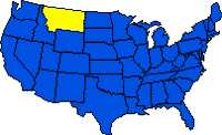
 Montana, one of the Mountain states, ranks fourth in size but is among the ten least populous of all the U.S. states. Bordering it are the Canadian provinces of British Columbia, Alberta, and Saskatchewan on the north; North Dakota and South Dakota on the east; Wyoming on the south; and Idaho on the west and southwest. Montana stretches for about 885 km (550 mi) from the ROCKY MOUNTAINS and Continental Divide in the west to the rolling plains in the east. The name Montana comes from the Spanish word montana, meaning “mountainous region.” Among the state’s nicknames are “Treasure State,” “Big Sky Country,” and the Indian designation, “Land of the Shining Mountains.”
Land & Resources
 The western third of Montana is rugged and mountainous, and the remaining eastern portion primarily consists of rolling plains. Granite Peak, Montana’s highest point, rises to 3,901 m (12,799 ft) in the Beartooth Range near Yellowstone National Park; the lowest elevation, 549 m (1,800 ft), occurs in the northwest, where the Kootenai River crosses into Idaho.
Physiographic Regions
Montana contains parts of three major physiographic regions–the Great Plains, a small section of the Middle Rocky Mountains, and a large section of the Northern Rocky Mountains. The GREAT PLAINS in eastern Montana have a general elevation range of 600 to 1,000 m (2,000 to 3,300 ft) and a deceptively flat-to-rolling overall appearance. On closer inspection, however, it is apparent that they are broken by small mountain masses (the Sweetgrass, Judith, Big Snowy, Bears Paw, Little Rocky, Highwood, and Crazy mountains) near the eastern edge of the Rockies and by the angular outlines of mesas, buttes, gullies, canyons, badlands, and naturally sculptured rock outcrops characteristic of a semiarid climate. The Middle Rocky Mountains rise west of the plains and include a small section of the Yellowstone Plateau, along with the rugged Absaroka and Beartooth ranges. The parallel ranges of the Northern Rockies, separated by narrow canyons, form a 322-km-wide (200-mi) belt of rugged mountains in western Montana.
Rivers and Lakes
Montana rivers drain toward the north, east, and west. A small area in the north central part of the state drains north to Hudson Bay by way of the Saint Mary and Belly rivers. Lands east of the Continental Divide drain into the Gulf of Mexico and Atlantic Ocean through the Missouri-Mississippi river system, and lands west of the divide drain into the Pacific Ocean by the Clark Fork and Kootenai rivers. Montana’s principal river is the MISSOURI. Its source is at Three Forks, where the Jefferson, Gallatin, and Madison rivers unite. It flows north, then eastward, where it receives its major tributaries–the Milk, the Musselshell, and, east of the state border, the YELLOWSTONE. Flathead Lake is the largest natural lake, and Fort Peck Lake on the Missouri River is the largest of many artificial water bodies created for irrigation and production of hydroelectricity.
Climate
January temperatures range from -12 deg C (11 deg F) in the northeast to -6 deg C (22 deg F) in the southwest, but in unusually cold years the average may be -18 deg C (0 deg F). Winters usually bring short-lived cold spells of high winds, blowing snow, and colder temperatures, interspersed with mild periods of chinook weather–warm, dry winds that evaporate the snow cover east of the Continental Divide. In 1954, Montana experienced the coldest temperature of any state in the conterminous United States when a low of -57 deg C (-70 deg F) occurred at Rogers Pass, northwest of Helena. July temperatures average between 23 deg C (73 deg F) in the southeast and 18 deg C (64 deg F) in the southwest. The hottest temperature ever recorded in Montana, 47 deg C (117 deg F), occurred (1937) at Medicine Lake. Precipitation, concentrated in late spring, is sparse, averaging 380 mm (15 in) over most of the state, with extremes of more than 2,540 mm (100 in) in exposed mountain areas in the west and less than 178 mm (7 in) in a few south central valleys. Severe hailstorms occasionally strike in summer. Droughts, blizzards, and unexpectedly early or late snows are other climatic hazards.
Historic Sites
Historical markers identify the 3,122-km-long (1,940-mi) Lewis and Clark Trail of the early explorers. The Little Big Horn Battlefield National Monument commemorates Custer’s Last Stand against the Sioux and Cheyenne in the 1876 Battle of the LITTLE BIGHORN. Big Hole National Battlefield marks the 1877 victory of the NEZ PERCE Indians under Chief JOSEPH, and Chief Joseph Battleground State Monument commemorates the chief’s surrender. Chief Plenty Coups State Monument preserves the home of this famous Crow leader along with ethnographic materials of the Crow people. Saint Mary’s Mission log church and pharmacy are remains of Montana’s first permanent settlement. Ghost towns at Bannack, Elkhorn, Virginia City, and Pony recall gold-rush days.
Tourism
Montana’s tourist attractions include GLACIER NATIONAL PARK and YELLOWSTONE NATIONAL PARK; Bighorn Canyon National Recreation Area; vast mountain and wilderness areas; excellent hunting, fishing, and camping; and dude ranches, ski resorts, and annual rodeo events. Bozeman, Missoula, Whitefish, and Red Lodge are tourist centers.
History
In the early 1700s, Indian tribes, including the Blackfoot, Sioux, Crow, and Cheyenne who had been displaced from lands farther east, began moving into Montana, pushing local tribes–including the Flatheads, Shoshoni, and Kutenai–westward toward the mountains. The first recorded visit by Europeans occurred in 1805, when the explorers Meriwether LEWIS and William CLARK, accompanied by their Shoshoni Indian guide SACAGAWEA, ascended the Missouri and Jefferson rivers to cross the Rocky Mountains (see LEWIS AND CLARK EXPEDITION). In 1807, Manuel Lisa established the first fur-trading post on the Big Horn River. Many trappers and traders, the so-called MOUNTAIN MEN, soon followed. Lisa’s post, along with others, was destroyed by hostile Indians. Montana’s first permanent white settlement did not appear until Father Pierre Jean DE SMET founded Saint Mary’s Mission in 1841.
Gold was discovered in 1858 at Goldcreek in small amounts and in larger amounts in the 1860s at Grasshopper Creek (now Bannack), Alder Gulch (Virginia City), Last Chance Gulch (Helena), and Confederate Gulch (Diamond City). The resulting gold rush brought a large influx of white settlers and ushered in a colorful decade, replete with stories of fortunes made and lost overnight, murderous road agents preying on stage coaches and miners, corrupt sheriffs, and citizens’ VIGILANTE groups. In 1863 western Montana, which had been successively part of Oregon and Washington territories, was united with eastern Montana, previously part of the territories of Louisiana (1805), Missouri (1812), Nebraska (1854), and Dakota (1861), in the Idaho territory. In 1864 separate territorial status was achieved, with the capital first at Bannack, then Virginia City, and, after 1875, at Helena.
In the 1860s stockmen began trailing cattle northward from Texas and conflict with the Indians intensified. In the Sioux War of 1875-76, the forces of Lt. Col. George Armstrong CUSTER were annihilated at Little Bighorn, but government troops subsequently subdued and removed the hostile Indians to reservations. Railroads crossed the region in the 1880s, further stimulating cattle and sheep ranching and indirectly setting off a fierce struggle between cattle- and sheepherders for priority grazing rights. In the mountains copper king Marcus DALY developed Butte Hill from a rough silver camp to a vast industrial complex of copper mines, mills, and smelters. Political life came increasingly to revolve around copper and Daly’s bitter rivalry with two other copper kings, William Andrews CLARK and F. (“Fritz”) Augustus Heinze. On Nov. 8, 1889, after five years of effort, Montana became the 41st state.
From 1909 to 1918 homesteaders arrived by the thousands to fence and plant the range with grain crops. Favored by unusually abundant rainfall, the farms flourished, but a series of dry years beginning in 1917 forced abandonment of many homesteads. In the DEPRESSION OF THE 1930s, many mines closed. Since then greater diversity and stability have been introduced by the development of irrigation facilities, tourism, and petroleum and coal resources. Copper’s dominance has been broken, and coal mining holds great promise for future economic growth. Large-scale strip mining began in the 1960s, and production has increased substantially, although not as dramatically as in most neighboring states. Montana’s high coal-severance tax, together with environmental concerns, has slowed development. In the 1980s, Montana struggled with state budget deficits. Montana’s first state lottery opened in 1987, following a voter initiative.
Land
- Area: 380,847 sq km (147,046 sq mi); rank: 4th.
- Capital: Helena (1990 pop., 24,569).
- Largest city: Billings (1990 pop., 81,151).
- Counties: 56.
- Elevations: highest–3,901 m (12,799 ft), at Granite Peak; lowest–549 m (1,800 ft), at the Kootenai River.